Virginia assesses state water quality, the good and the bad
0Water quality evaluation results for the entire state of Virginia were released yesterday by the state’s Department of Environmental Quality. The water quality assessment integrated report detailed a six-year water quality assessment of 98 percent of the state’s 1,247 watersheds, including a list of impaired waterways.

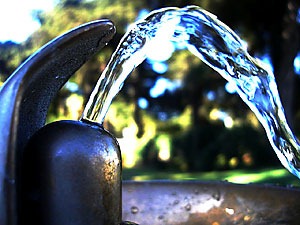
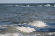
Waterfall on the Potomac River near Great Falls, Virginia
This year alone, 1,400 miles of streams and rivers and 2,500 acres of lakes were added to the impaired list.
“Impaired” status, as defined by the DEQ, is based on six designated uses for water — whether they can support aquatic life, fish consumption, public water supplies, shellfish consumption, swimming, and wildlife.
Some of the problems uncovered throughout the water quality investigation include the presence of E. coli bacteria, pollution in the form of PCBs and mercury, low dissolved oxygen and pH levels, as well as some other naturally occurring pollutants such as chloride.
The state is now establishing total maximum daily loads of allowable pollutants. The Environmental Protection Agency defines a TMDL as a computation of the maximum amount of a pollutant that a water body can receive and still safely meet water quality standards.
Even with the daily load limits, government officials still need to develop more than 1,200 cleanup plans to get the water quality problems under control.
The data “should alarm all who value clean water, public health, and a vibrant economy,” said Chesapeake Bay Foundation Senior Scientist Mike Gerel.
“Virginia simply must take more aggressive steps to reduce pollution, especially pollution running off farms, streets, and parking lots,” he said.
Despite the results, state officials said there are no immediate threats to human health in the waters listed as impaired, though they are urging people to be aware of fish consumption advisories and not to swallow any “low quality” water.
“We continue to find watersheds where pollution is a problem,” DEQ Director David Paylor said Monday. “But we also are seeing more areas where water quality has improved. This is good news that we expect to continue as our cleanup efforts progress throughout the state.”
Fourteen years ago, Virginia state officials announced that 7 percent of rivers were polluted. Now in 2010, looking at the dirty waters as a proportion of total river miles, the number has more than tripled and stands at 23 percent.
Impaired water in the state constitutes roughly 20 percent of rivers and streams, 83 percent of lake area, and 98 percent of estuary area, according to the report. These numbers take into account that sufficient information was not provided for about 34,500 miles of streams and rivers (out of 52,232 total miles), and 3,700 acres of lakes and reservoirs (out of 116,230 total acres).
How safe do you think it is to continue recreational activities in and around “impaired” bodies of water? Drop a line in the comments below to share your thoughts.
More state rivers, lakes impaired by pollution [fredricksburg.com] Va. to release water quality report [The Washington Post] Virginia’s polluted waters list gets longer [Daily Press] Va. water quality report shows mixed picture [WTKR, Norfolk, VA]
Image Credit: bern161616