Research Summary: Tributary Phosphorus Monitoring in the U.S. Portion of the Laurentian Great Lakes Basin: Drivers and Challenges
0
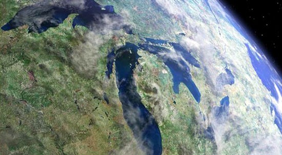
The Laurentian Great Lakes Basin is home to a vast human population and ecosystem with competing demands for land and water, giving rise to concerns associated with resource health and sustainability. One particular complex issue is the eutrophication of the Great Lakes, which is caused largely by excessive amounts of phosphorus. Phosphorus enters the Great Lakes via streams that drain the surrounding watersheds, which are home to urban centers, agricultural lands, and extensive forests. According to the International Joint Commission (IJC), these watersheds are being subjected to numerous stressors, including land use and climate change (IJC, 2003), potentially resulting in greater quantities of phosphorus entering the lakes because of increased stream flow flashiness, decreased soil infiltration rates, and greater soil erosion (Murdoch et al., 2000).
In this work, we examine the monitoring network currently in place for sampling the amount of phosphorus entering the U.S. Great Lakes from tributaries by asking the question, what are the challenges faced by the agencies and organizations responsible for maintaining this network? Data generated by this network serves to detect trends at specific locations and as input to basin-wide water quality models. Such models are vital for estimation of loads, and predicting how changes in land use and climate will affect nutrient concentrations in the Great Lakes. The primary drivers and challenges associated with effective phosphorus monitoring programs were examined through interviews with the stakeholders responsible for a portion of the monitoring networks for the Great Lakes.
This analysis is based on interviews with stakeholders associated with agencies that operate U.S. tributary monitoring stations. To identify stakeholders for interviews, we focused on the agencies that collected data for the 128 water quality monitoring stations in the basin that were used to calibrate the Upper Midwest SPARROW model (Robertson and Saad, 2011). These are stations that generated sufficient stream flow and P concentration data between 1970 and 2006. Data generated by these stations also represent a portion of the data used by researchers computing loads with the Beale’s ratio estimator (Dolan and Chapra, 2012). To understand the historical, current, and future status and trends in water quality monitoring within the Great Lakes Basin, we investigated why and how these agencies’ stakeholders develop, manage, and fund water quality monitoring programs.
Interviews with representatives of monitoring agencies operated by state, federal, university or private organizations in the Great Lakes basin were conducted in February through April of 2012. The interviews consisted of ten multi-part, open-ended questions designed for programs that had continuous, intermittent, and ceased monitoring sites. The interviews were conducted with program managers, coordinators or directors of the monitoring programs who had intimate knowledge of the monitored sites, program goals, and program needs.
Based on these interviews, we identified three issues that policy makers interested in maintaining an effective phosphorus monitoring network in the Great Lakes should consider. First, the objectives driving the development and operation of tributary monitoring programs vary across the basin, resulting in spatial and temporal differences in sampling frequency and design across the basin. Second, these differences in sampling designs limit the ability of the various programs across the Great Lakes to coordinate efforts for collaboration and data sharing. Finally, the consistency of funding for tributary water monitoring programs varies by program, complicating any long-term effort to generate sufficient water-quality data for use in understanding phosphorus trends and loads.
Based on these findings, we recommend the following actions for improving monitoring networks for assessing phosphorus loads into the Great Lakes:
- Provide states with incentives to support the monitoring of phosphorus for the purpose of estimating loads to the Great Lakes. Among other things, doing so will encourage state-level program managers to participate in discussions involving basin-wide goals and how to adjust their sampling region in ways supportive of those goals.
- Identify phosphorus monitoring protocols that include enough samples to identify trends and quantify loads at a level of certainty necessary for use in statistical models and load control programs. Establishing such protocols will help program managers across the basin to develop an integrated plan for characterizing phosphorus loads in the Great Lakes Basin by establishing similar sampling frequencies and site selections criteria.
- Develop funding mechanisms consistent with long-term policy goals. If the goal is to generate data for the long-term monitoring of phosphorus loads, the funding mechanism must be sufficient to meet those goals without agencies having to constantly fight for resources. For states, the funding programs in Michigan and Minnesota can serve as potential models. In addition, greater inter-agency collaboration could also result in greater federal funding for long-term monitoring.
The implementation of these recommendations would represent an important step toward developing a sustainable, coordinated system of long-term monitoring to provide data for modeling and calculating tributary loading of phosphorus into the Great Lakes. The increase in monitoring and data will provide for more efficient ecosystem restoration and other efforts related to protecting the Great Lakes, given the backdrop of changing landscape and climate and introduction of exotic species in the Great Lakes.
Full study published 2013 in Journal of Great Lakes Research 39 (4): 569-577. Additional study authors include Hugh Gorman, Alex Mayer, David Dempsey and Alicia Sherrin.
Acknowledgements
This work was supported by award CBET- 0725636 from the National Science Foundation. Thanks are due to USGS Wisconsin Science Center for support in data availability in the Great Lakes Region. Thanks also for the water quality managers across the basin for donating their valuable time for the interviews described in this work.
References
- International Joint Commission (IJC), 2003. Climate Change and Water Quality in the Great Lakes Region: Risks, Opportunities and Responses. Report for the Great Lakes Water Quality Board. www.ijc.org/rel/pdf/climate_change_2003_part3.pdf. Last accessed September 13, 2012.
- Murdoch, P.S., Baron, J.S., Miller, T.L., 2000. Potential effects of climate change on surface-water quality in North America. J. Am. Water Resour. Assoc. 36 (2): 347-366
- Robertson, D.M., Saad, D.A., 2011. Landscape-derived nutrient inputs to the Laurentian Great Lakes by Source and Watershed. J. Am. Water Resour. Assoc. 47: 1011-1033.
- Dolan, D.M., Chapra, S.C., 2012. Great Lakes total phosphorus revisited: 1. Loadings. J. Great Lakes Res. 38 (4): 730-740.
Top Image: A riparian strip in Putnam County, Ohio sitting between farmland and a Lake Erie tributary. (Credit: U.S. Department of Agriculture via Wikimedia Commons)


