USGS study aims to refine Great Lakes beach monitoring
0
A collaborative U.S. Geological Survey research project is seeking to better understand how harmful pathogens spread to Great Lakes beaches in order to enhance the effectiveness of beach monitoring programs.
As previously noted, as many as 10% of Great Lakes beachgoers complained last year of getting sick after swimming at open beaches. Not only does lake pollution make people sick, it also takes its toll on the region’s multi-billion-dollar recreation and tourism industries.
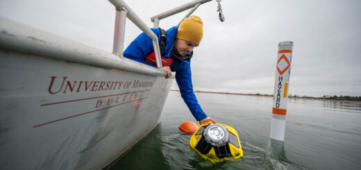
The Great Lakes Ocean Research Priorities Plan, a collaboration of U.S. Geological Survey researchers from the Water Science Centers and Great Lakes Science Center, aims to refine the techniques and science used to asses recreational water quality so as to provide managers with better data with which to make beach closure decisions. A network of Great Lakes buoys will help gather real-time data for the study.
Current practices for monitoring beach water quality rely on culturing fecal-indicator bacteria, a process that can take as long as 24 hours, at which point beach closures and advisories may be too late.
There are problems that arise when using fecal-indicator bacteria to gauge the presence of harmful pathogens. Pathogens, the USGS notes, often have different transport and survival properties than the fecal bacteria that is used to indicate their presence.
USGS researchers hope to better understand how hydrologic properties influence these organisms and their transport patterns. There has not yet been a comprehensive Great Lakes study on the relations “between coastal processes (sediment transport and storage, ground-water/surface-water interactions, wave actions, seiches, etc.) and bacteria concentrations,” according to the USGS.
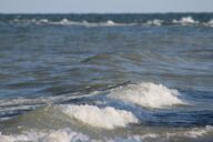
Aiding in the research is a real-time hydrological and meteorological monitoring network. Nearshore buoys are equipped to monitor wave actions and other hydrological properties. Absolute level transducers are suspended beneath the buoys to measure information on wave energy.
With a fast enough sampling rate, these level transducers are capable of monitoring data about wave frequency and height. The sensor is mounted at a fixed location underwater and calculates the height of the water column above it. As a wave crest passes by, water column height increases; when troughs approach, it decreases. The resulting record of sea surface elevations can be used to calculate wave energy data.
The wave measurements will be combined with other real-time data, such as turbidity, as well as on-shore photosynthetically active radiation (PAR) and precipitation. This data will be analyzed along with routine water quality sampling at a number of beach sites.
What solutions do you think are needed to monitor Great Lakes beach health hazards more effectively? Share your thoughts in the comments below.
OWML: Current Projects [U.S. Geological Survey] NexSens Great Lakes buoys aid beach pollution study [Fondriest Environmental]
Image Credit: http://www.flickr.com/photos/igboo/3844577062/in/photostream/