Numerous studies examine Fayetteville Shale area water resources
0
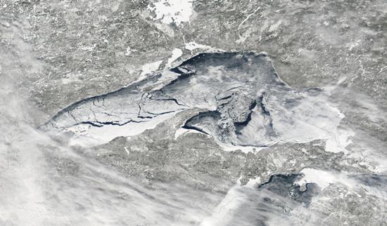
Greers Ferry Lake
Various government agencies and universities, including the U.S. Geological Survey, have either proposed or already began studying water resources in the Fayetteville Shale gas drilling development area, located in northern Arkansas. Methods for data collection and analysis will include environmental monitoring and computer modeling and simulation.
The interest in studying the area’s water resources stems from the environmental and human health concerns surrounding the drilling process. In order to accurately gauge the short- and long-term effects of drilling, a baseline of environmental data that spans the region must be established.
“Continued collection of water-resources data and analysis of historic data, along with interpretive studies, are especially important to document existing conditions in areas of natural resource development such as the Fayetteville Shale,” said Dave Freiwald, director of the USGS Arkansas Water Science Center.
The USGS began water quality and flow monitoring of the region in 2009 on the South Fork of Little Red River. The agency is working with the U.S. Forest Service, Arkansas Game and Fish Commission, Arkansas Water Resources Center, and the University of Arkansas to measure temperature, specific conductance, pH, dissolved oxygen, turbidity, water level, flow, and rainfall at two stations on the South Fork.
With help from Southwestern Energy, the USGS has also developed a simulated watershed model of the hydrological processes within the 24-square-mile Cypress Creek Basin. The work was completed as part of a two-year study of the basin that aimed to simulate the hydrological and sedimentation processes associated with proposed impoundments (used as water supply ponds for gas extraction operations), proposed well pads, current and proposed gravel roads, and current land use practices. The model continues to be refined as additional base-flow and storm-flow condition data for the basin is collected.
Eight USGS stream gauging stations are currently operational in the Fayetteville Shale area, and three sites on Greers Ferry Lake have been used to collect water quality samples since late 2009. Other studies and sampling efforts are in the proposal stages with unsecured funding; the work ranges from monitoring various springs and groundwater sources to developing a fully three-dimensional description of the hydrogeologic units throughout northern Arkansas to be used for characterizing groundwater flow. Any research exploring what the shale gas area might effect is of interest.
“Virtually all of the wastewater produced in the gas drilling and hydrofracking processes contain salts,” explained Tim Kresse, USGS water quality specialist. “Change in the electrical conductivity — affected by salinity — of water sampled from wells and streams is an excellent indicator of potential effects of drilling in an area, but to make this approach more effective, background water-quality sampling is needed before any drilling occurs. If higher concentrations of salts are observed near drilling areas, additional sampling and analyses may be warranted.”
USGS studying water resources of Fayetteville Shale [The Sun-Times] Image Credit: http://www.greersferrylake.org/content/area-information/