High School Senior’s Class Project Finds Lake Champlain Is On The Rise
0Utilizing public data available from the U.S. Geological Survey, high school senior Brendan Murphy has found that Lake Champlain has risen nearly a foot since 1971, according to Seven Days Vermont. His work confirms what many living near the lake have observed for decades.
During the early ‘70s, Lake Champlain’s average water level was 95.5 feet above sea level, assessed by researchers at the University of Vermont using technology of the era. That number, outdated today, has been used as a legal standard in property disputes and zoning issues well into the 21st century.

Sail boats on Lake Champlain. (Credit: Wikimedia Commons User Travisleehardin)
Murphy, who had a modern computer and access to a wealth of USGS data, found the old, hand-tallied figures were off by a few-tenths of a foot. Authors of the 1971 study welcome the news.
“I’m flattered in a way,” said Richard Downer, a retired professor of civil and environmental engineering, to Seven Days Vermont. “You could say that that was my job for 34 years (at UVM), to encourage young people to ask questions and do these kinds of calculations.”

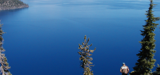
Lake Champlain as seen from Overlook Park. (Credit: Flickr User Vagn via Creative Commons)
The next step is explaining the rise, something Downer and other experts have struggled to do. Many agree that climate change is not the cause, but just one of several contributing factors that are natural or human-caused.
A professor attending Murphy’s presentation to the Vermont Geological Society suggested the growth of aquatic plant life could be slowing Lake Champlain’s drainage to the north. Downer posits isostatic rebound, or the resurgence of earth after a glacier’s melting, which he says is still active at the lake’s northern end. A narrowing of Canada’s Chambly Canal, which took place in the ‘70s, could also have contributed to the rise by restricting water flowing out of Lake Champlain.