Scientists Measure Volcanic Heat Under Lake Rotomahana
0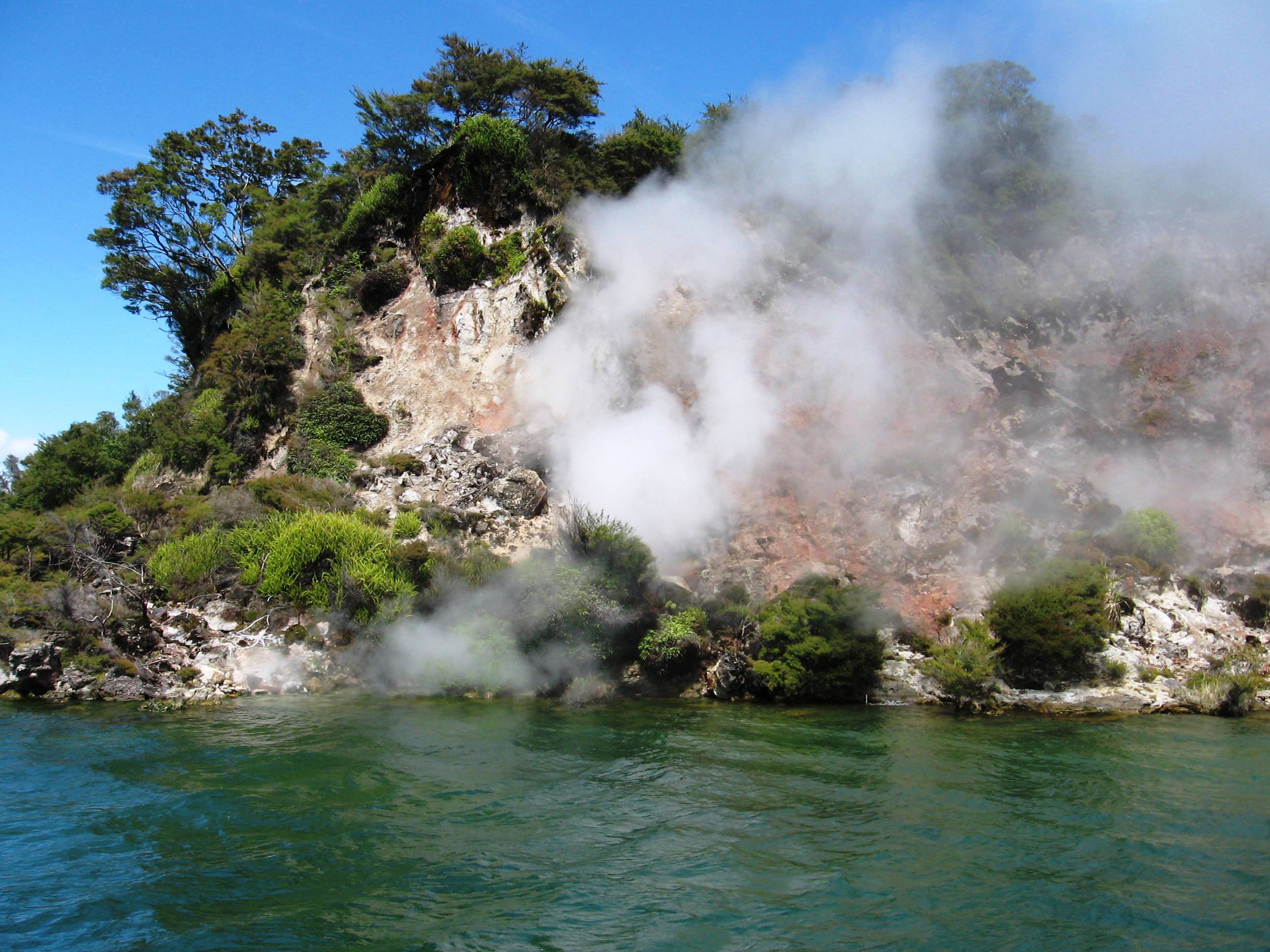
A section of rocks along Lake Rotomahana, once part of the famous pink and white terraces that lined the lake’s north end. (Credit: Flickr User JSilver via Creative Commons)
In the 19th century, Lake Rotomahana in New Zealand supported one of the world’s natural wonders: pink and white terraces. The formations were made of volcanic rock and mineral deposits. Rotomahana was their only known location.
Built from past eruptions of a nearby volcano (Mount Tarawera), they were the country’s most popular tourist destination. They sat on the lake’s north end and were commonly reached by canoe.
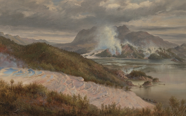
Image of oil painting depicting Lake Rotomahana’s pink terraces. By Charles Bloomfield in 1886. (Credit: Museum of New Zealand)
When an eruption occurred in June 1886, the terraces were thought to be lost. According to the American Geophysical Union:
“A large, steaming crater replaced the lake and the Pink and White Terraces were apparently destroyed. The crater re-filled during the next 15 years and today Lake Rotomahana is considerably deeper (125 m) and ~5 times larger than pre-eruption.”
A 2011 study used mapping technology to discover that part of the terraces were still intact, a few hundred feet under the surface. Images of the pink terraces were released to the public and the bottom two tiers of white terraces are still said to exist underwater.
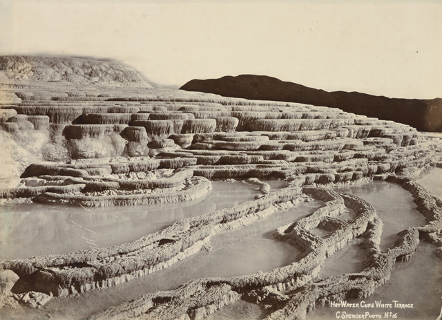
Black and white photograph of Lake Rotomahana’s white terraces, 1885. By Charles Spencer. (Credit: Museum of New Zealand)
As Cornel de Ronde, geologist with GNS Science, described at the time:
“I think this is a really significant find. I’ve had people say to me that this is New Zealand’s Titanic and I think it’s a lot bigger than that.”
Recently, scientists have gone back to Lake Rotomahana. This time they’re not looking for rock – but heat.
Armed with heat sensors and high-resolution cameras, researchers are studying the geothermal system under the lake for the first time.
As de Ronde puts it:
“Once we have the information about the lake’s heat energy output, we will be able to put together a comprehensive story on the evolution of the volcano-geothermal system since the Tarawera eruption of 1886.”
Initial findings indicate that some locations in the lakebed emit five times more heat than vents in the Pacific Ocean.
Video: Geothermal survey of lakebed. (Credit: New Zealand Herald)