Research Summary: Classifying Lake Ecological States Using Satellite Remote Sensing For Flamingo Lakes In The East African Rift Valley
01University of Leicester, Department of Physics & Astronomy, University Road, Leicester, LE1 7RH, UK
2University of Leicester, Centre for Landscape and Climate Research, University Road, Leicester, LE1 7RH, UK
3King’s College London, Department of Geography, Strand Campus, London, WC2R 2LS, UK
Introduction
Lesser Flamingos are a near-threatened species which depend on a network of 15 alkaline-saline lakes in East African Rift Valley (Childress et al., 2008). They feed by filtering cyanobacteria and benthic diatoms from the lakes’ waters (Tuite, 2000). Alkaline-saline lakes undergo large fluctuations in lake level which impact strongly on water chemistry and hence biology. Very limited in situ data are available for these lakes so alternative methods for monitoring are required. Satellite imagery has the potential to provide information on the ecological state of alkaline-saline lakes, enabling the long term spatial and temporal variability of the flamingos’ food supply to be investigated. Hence, this study aimed to develop a Landsat-based classification scheme for Rift Valley lakes.
Method
In situ spectral reflectance measurements and water quality parameters were collected at a range of alkaline-saline lakes. These data were then used to identify the spectral features characteristic of particular ecological states and to develop a decision tree which assigned a class based on the reflectance in Landsat bands 2, 3 and 4. Full details of the classification scheme and its development can be found in Tebbs (2014) and Tebbs et al. (2015). The classification was applied to atmospherically corrected Landsat imagery to produce classified maps and timeseries.
Results
The in situ spectra re-sampled to Landsat bands were used to identify five classes which had distinct spectral shapes and ecological significance (Figure 1). An additional class, not present in the in situ dataset, was identified in Landsat imagery. Based on these data, a decision tree was developed which could distinguish six classes: (1) Low biomass; (2) Sediment; (3) Scum; (4) Bleached scum; (5) Microphytobenthos; (6) High cyanobacterial biomass. When verified against in situ measurements, the decision tree had an overall classification accuracy of 77%.

Figure 1. In situ reflectance spectra re-sampled to Landsat ETM+ bands, sorted into the following classes based on in situ water parameter measurements: `Low biomass and non-vacuolate’ (A); `Sediment’ (B); `Scum’ (C); `Microphytobenthos’ (D) and `High biomass’ (E). (Credit: Tebbs, et al.)
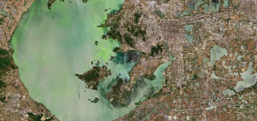
Classified maps and timeseries were produced for several key lakes which showed the different ecological behaviours of these complex systems (Figure 2; timeseries in Tebbs et al. 2015). Results showed that Lake Logipi regularly supports significant food reserves for flamingos and hence the lake may act as a refuge for flamingos when their other main feeding lakes are not suitable.

Figure 2. True colour Landsat imagery and classified maps for lakes Bogoria (A), Nakuru (B), Elmenteita (C), Logipi (D), Naivasha (E) and Natron (F).
Conclusion
This study has demonstrated the potential of Landsat for providing ecologically valuable information on inland waters at a regional scale. A classification scheme was developed for determining the ecological state of alkaline-saline lakes using Landsat, with accuracy of 77%. Results highlighted the potential importance to Lesser Flamingos of Lake Logipi – a lake which is difficult to study in situ due to its extreme remoteness.
Full study published in International Journal of Applied Earth Observation and Geoinformation, 2015.
Acknowledgements
Thanks to the Centre of Interdisciplinary Science, University of Leicester, for funding the PhD that produced this work.
References
- Childress, B., Nagy, S., Hughes, B., & Abebe, Y. (2008). International Single Species Action Plan for the Conservation of the Lesser Flamingo, Phoeniconaias Minor. CMS Technical Series No. 18 / AEWA Technical Series No. 34
- Tebbs, E., 2014. Remote sensing for the study of ecohydrology in East African Rift lakes. Ph.D. thesis, Available at https://lra.le.ac.uk/handle/2381/28918?mode=full.
- Tebbs, E. J., Remedios, J. J., Avery, S. T., Rowland, C. S., & Harper, D. M. 2015. Regional assessment of lake ecological states using Landsat: A classification scheme for alkaline-saline, flamingo lakes in the East African Rift Valley. International Journal of Applied Earth Observation and Geoinformation, 40, 100–108. doi:10.1016/j.jag.2015.03.010
- Tuite, C. H., 2000. The distribution and density of lesser flamingos in East Africa in relation to food availability and productivity. Waterbirds, 23, 52-63.
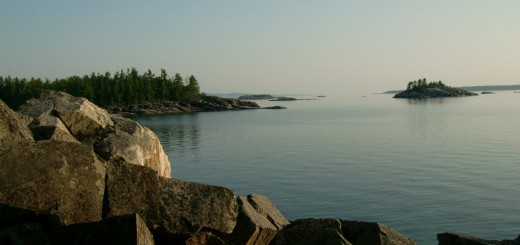
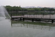
Featured Image: Lake Elmenteita. (Credit: Flickr User Xiaojun Deng via Creative Commons 2.0)