Research Brief: Evaluating a Novel Storm Surge Prediction Model on Lake Ontario
0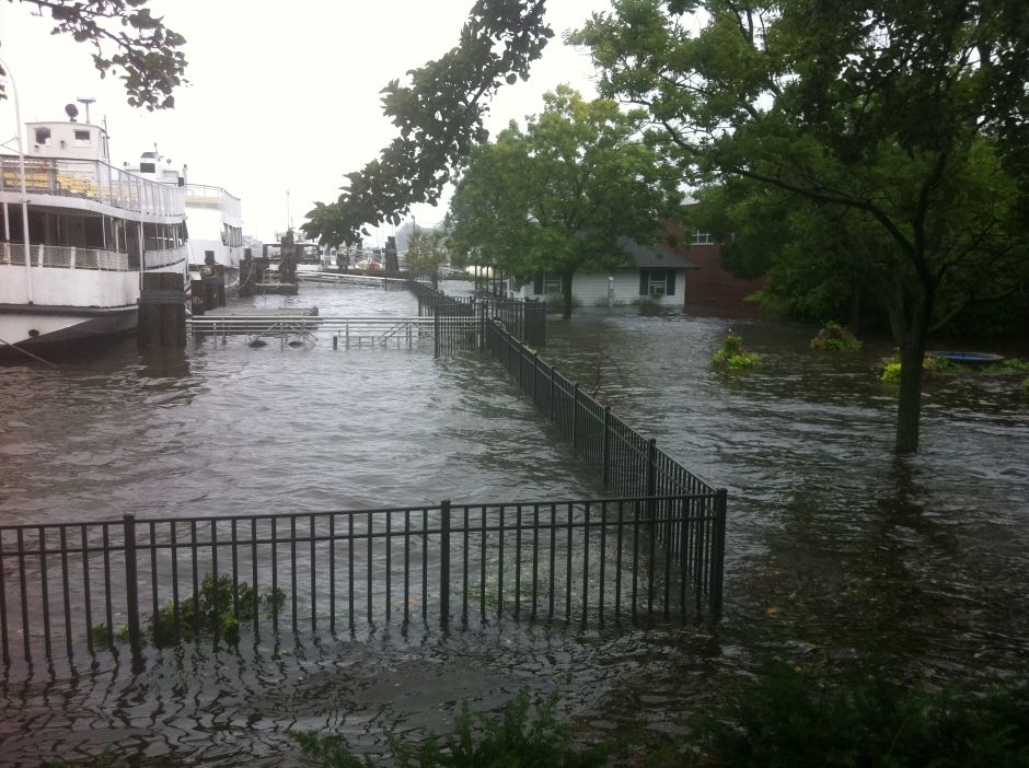
Storm surge from Hurricane Irene in Greenwich, Connecticut. (Credit: Cyclonebiskit via Wikimedia Commons CC BY-SA 3.0)
In coastal communities, extreme weather events can generate strong winds, large waves and a storm surge. These surges can leave coastal regions submerged as water levels rapidly rise. Being able to predict these events is a matter of public safety, informing evacuation orders and other warnings.
Many of the storm surge forecasts available require high-processing power to run, yielding increasingly more accurate forecasts the smaller the horizon is. In the Great Lakes, the Great Lakes Coastal Forecasting System (GLCFS) is commonly used to predict storm surges.
A 2024 study published in Geoscience Model Development developed an open-source storm surge forecasting model on Lake Ontario (Coastlines-LO). The goal of the newly developed model was to offer the same accuracy as GLCFS with lower processing.1
The study defines the difference between the two models, claiming, “Differences between predictions from these models can be explained according to the setup of each system, including different hydrodynamic models, grid resolutions, and atmospheric forcing inputs.”1
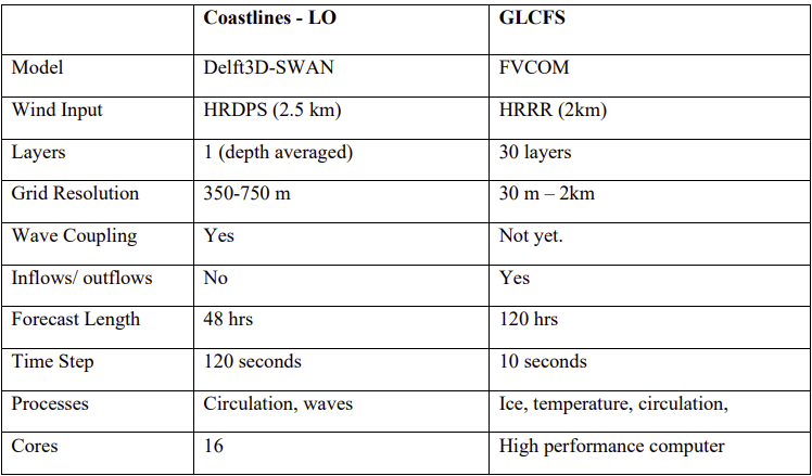
Overview of modelling approach differences between Coastlines-LO and the GLCFS. Details for the setup of the GLCFS are sourced from NOAA’s GLERL webpage (https://www.glerl.noaa.gov/res/glcfs/) and various model validation studies (Kelley et al., 2018; Peng et al., 2019). Figure from Swatridge et al., 2024.
Methods
The Coastlines-LO model uses a dynamically coupled Delft3d-SWAN model with a structured grid to generate 48-hour storm surge predictions (more specifically, water levels and waves) for Lake Ontario. Predictions are updated every 6 hours and driven by spatially varied wind fields from a high-resolution wind forecast model.
The model was applied to Lake Ontario over a 20-month operational period, and the ability of the model to reproduce a storm surge was investigated over a 4-month period when multiple storm events occurred.
The forecasts produced by the Coastlines-LO model were compared to observational data from data buoys on the lake to evaluate accuracy and then compared to the established GLCFS to determine variances in performance.
Results
Both models performed similarly when validated against buoy observations, “with good agreement found between modelled and predicted total wind speeds and directions.”1 Peak wind speeds were underrepresented by at most 4.21 m s−1 at Northwest Lake Ontario and overpredicted by up to 2.61 m s−1 at Prince Edward Point.
There were relative errors between observed and forecasted storm surge magnitudes and wave heights of less than 15%. Larger errors typically occurred in areas with larger ranges in observed water levels.
Overall, the model was found to be effective in simulating short-term fluctuations associated with storm surges (water level and wave conditions) and could be adapted to other Canadian lakes and coastal seas with available bathymetry data to feed into the model.
Source
- Swatridge, L. L., Mulligan, R. P., Boegman, L., and Shan, S.: Development and performance of a high-resolution surface wave and storm surge forecast model: application to a large lake, Geosci. Model Dev., 17, 7751–7766, https://doi.org/10.5194/gmd-17-7751-2024, 2024.