Hamilton Harbour AOC remediation plan shows signs of progress
0
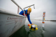
The proposed remediation of Randle Reef in Hamilton Harbour involves the construction of a steel containment facility, as seen in the above rendering, that will contain contaminated sediments and serve as a pier.
After years of delays, a project to contain contaminated sediments in a Canadian Great Lakes Area of Concern might be showing signs of moving forward.
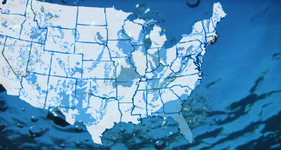
The 2,150 hectare Hamilton Harbour is located at the western tip of Lake Ontario. It’s considered the most complex and most highly contaminated sediment sites out of the nine Canadian AOCs.
Several urban centers are located within in the watershed, and the harbor is fraught with bacterial contamination. Roughly 40 to 50 percent of the water in the harbor comes from discharges of four wastewater treatment plants as well as from combined sewer overflows.
Randle Reef, a shallow area near a U.S. Steel Canada plant, is one of the major obstacles to having the harbor de-listed. It is heavily contaminated with toxic coal tar that contains high concentrations of polycyclic aromatic hydrocarbons (PAHs). The sea bottom sediment also contains heavy metals and industrial chemicals.
The harbor’s remedial action plan gives high priority to containing this massive accumulation of toxic sediments in the reef. The cleanup plan involves building a large steel containment structure around the most toxic sediment, covering it with less toxic mud from other areas in the harbor, then capping it to create a pier.
The Hamilton Port Authority submitted design plans for this containment structure to the federal government for approval, giving hope that work on the delayed project will at last begin. The Port Authority opened the project to a 30-day public comment period, and a copy of its application to the Minister of Transport — including location and engineering schematics — are publically available. Another call for public comment will occur during the environmental assessment of the project.
The proposed Randle Reef containment structure (PDF) would be about 9.5 hectares in size and constructed with a double steel sheet pile wall. It will be built around about 130,000 cubic meters of the most toxic sediments in the area. Approximately 500,000 additional cubic meters of contaminated sediment will be dredged from the surrounding area, as well as other toxic sites in the harbor, and placed within the containment facility.
A major obstacle for the project still remains, however. The city of Hamilton has yet to commit to match the federal and provincial financial contributions. Both the federal government and Ontario have approved $30 million each for the project. The total cost has risen from $90 million to about $105 million over the years the project has been delayed.
As financial planning continues, the toxic sediments continue to disperse throughout the water, making containment more difficult.
There are nine Areas of Concern in Canada, 25 in the U.S., and 5 additional sites shared by both countries.
Randle Reef project inches forward [The Hamilton Spectator] Hamilton Harbour Area of Concern [Environment Canada] Randle Reef Sediment Remediation Project (PDF) [Bay Area Restoration Council]
Image Credit: www.hamiltonharbour.ca/documents/hamilton_harbour_panels_2008_000.pdf