• News
  • Lake Facts
  • About

Lake Scientist

Rare Fish Reclaims Habitat, Halts Lake Cumberland Refill

0
  • by Daniel Kelly
  • — January 31, 2014
Lake_cumberland_tennessee

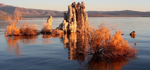
Lake Cumberland (Credit: Tyler White via Wikimedia Commons)

After structural issues were found on Lake Cumberland’s Wolf Creek dam, substantial repair work took place. The U.S. Army Corps of Engineers completed a new wall in March 2013. The massive concrete wall is 4,000 feet long and 275 feet thick.

With the new barrier in place, the Army Corps began to let water flow back in from the Cumberland River. By April, Lake Cumberland had risen 18 feet and businesses dependent on lake water were optimistic that tourists would come back for summer vacation.

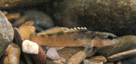
But Mother Nature had other plans. While the dam was being repaired, low levels in the Cumberland River provided ideal habitat for an endangered species of fish – the duskytail darter. It is native to Kentucky, Tennessee and Virginia.

Etheostoma_percnurum_duskytail_darter

Duskytail darter, Etheostoma percnurum. (Credit: Dick Biggins, U.S. Fish and Wildlife Service)

The tiny fish, with an average size of just more than two inches, worked its way up the Big South Fork of the Cumberland River, reclaiming five miles of the stream. And now releases of water back into Lake Cumberland have been halted.

Water levels are currently near 690 feet, 10 higher than during repairs, but about 35 feet lower than expected levels. The Army Corps, in consultation with the U.S. Fish and Wildlife Service, must complete an environmental survey to assess impacts to the fish before additional releases can move forward.

Share

You may also like...

  • Bacteria in Mono Lake’s Sand Breathe Toxic Elements
  • Frying Pan Lake is World’s Largest Hot Spring
  • blood falls Antarctica A Waterfall Runs Red Into Lake Bonney
  • Part of Tai Lake (Taihu) in China, as viewed by Hodoyoshi-1 satellite. Research Brief: Satellites Reveal Global Lake Water Storage Declines

Leave a Reply Cancel reply

Your email address will not be published. Required fields are marked *

Time limit is exhausted. Please reload CAPTCHA.

BUY AT FONDRIEST.COM
New NexSens XB200 Data Buoy
  • Recent Posts

    • A small mountain pond and fells surrounding Bárrás. August 2006. The region is dominated by arctic lakes and ponds much like this.Research Brief: Measuring Oxygen and Temperature Changes in Arctic Lakes Impacted by Climate ChangeMay 12, 2025
    • Spring 2025 Environmental Monitor Available NowMay 7, 2025
    • Research Brief: CyanoHABs Forecasting in Satellite Monitored LakesMay 5, 2025
    • Supplying Seattle’s Drinking Water: Using Data Buoys to Monitor the Cedar River Municipal WatershedApril 30, 2025
    • A high-mountain lake in Manti-La Sal National Forest.Research Brief: Threats to High-Mountain Lakes in the AlpsApril 28, 2025
  • Popular Tags

    Great Lakes research summary research pollution research brief Lake Erie Algae invasive species Product Spotlight climate change lake research lake science runoff nutrient-loading dissolved oxygen Lake Michigan international temperature Ohio eutrophication EPA toxic waters ice phosphorus USGS

©2025 Fondriest Environmental Inc. | Questions? Call 888.426.2151 or email customercare@fondriest.com