• News
  • Lake Facts
  • About

Lake Scientist

Lake Mead Water Levels Down 30 Feet Since February

0
  • by Daniel Kelly
  • — July 22, 2014

Lake Mead water levels have dropped 30 feet since February 2014, according to the Weather Channel. The largest man-made reservoir in the United States now sits at just 39 percent capacity.

lake mead water levels / Aerials Of Lake Mead National Recreation Area

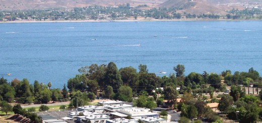
Aerial view of Lake Mead National Recreation Area. (Credit: CBS Las Vegas via Creative Commons)

At fault is a deepening drought affecting large portions of the nation’s southwest. Dry conditions have persisted there for 14 years, taking water levels down 130 feet since 2000.

Those heading to Lake Mead for recreation have had to walk over its dry-mud lakebed just to reach water in some cases. The National Park Service has been forced to close or extend boat ramps, and has even moved entire marinas to keep up with its recession.

Lake Mead water levels

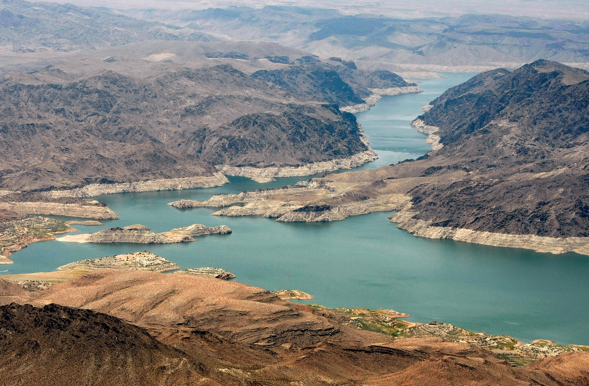
Lake Mead. (Credit: Joao Carlos Medau via Wikimedia Commons)

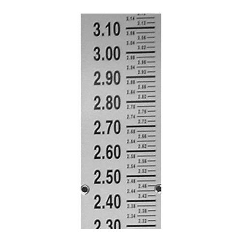
For those interested in tracking Lake Mead’s water levels from anywhere, lakemead.water-data.com updates daily with figures on the lake’s changing depths.

Share

You may also like...

  • Oroumieh (or Urmia) Lake World’s third-largest salt-water lake at risk of drying up
  • Despite lake level increases, anxiety lingers
  • Devils Lake Flood Devils Lake: forever on the rise
  • Product Spotlight: Solinst Levelogger Edge

Leave a Reply Cancel reply

Your email address will not be published. Required fields are marked *

Time limit is exhausted. Please reload CAPTCHA.

BUY AT FONDRIEST.COM
New NexSens XB200 Data Buoy
  • Recent Posts

    • Spring 2025 Environmental Monitor Available NowMay 7, 2025
    • Research Brief: CyanoHABs Forecasting in Satellite Monitored LakesMay 5, 2025
    • Supplying Seattle’s Drinking Water: Using Data Buoys to Monitor the Cedar River Municipal WatershedApril 30, 2025
    • A high-mountain lake in Manti-La Sal National Forest.Research Brief: Threats to High-Mountain Lakes in the AlpsApril 28, 2025
    • MODIS image of Lake Erie ice cover. February 6, 2009. Such physical climate-related shifts are easily captured by satellite imagery.Research Brief: Measuring Climate-Related Shifts in Lake EcosystemsApril 21, 2025
  • Popular Tags

    Great Lakes research summary research pollution research brief Lake Erie invasive species Algae Product Spotlight climate change lake research lake science runoff nutrient-loading international Lake Michigan dissolved oxygen temperature Ohio eutrophication EPA toxic waters ice USGS phosphorus

©2025 Fondriest Environmental Inc. | Questions? Call 888.426.2151 or email customercare@fondriest.com