Research Summary: Morphometry Of Lake Palmas, Deep Natural Lake In Brazil
01Espírito Santo State Water Resources Agency, Vitória, Espírito Santo, Brazil
2Department of Oceanography and Ecology, Federal University of Espírito Santo, Vitória, Espirito Santo, Brazil
Abstract
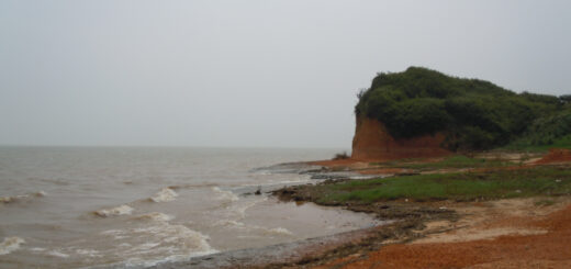
Lake Palmas (A = 10.3 km2) is located in the Lower Doce River Valley (LDRV), on the southeastern coast of Brazil. The Lake District of the LDRV includes 90 lakes, whose basic geomorphology is associated with the alluvial valleys of the Barreiras Formation (Cenozoic, Neogene) and with the Holocene coastal plain. This study aimed to investigate the relationship of morphometry and thermal pattern of a LDRV deep lake, Lake Palmas. A bathymetric survey carried out in 2011 and the analysis of hydrographic and wind data with a geographic information system allowed the calculation of several metrics of lake morphometry. The vertical profiling of physical and chemical variables in the water column during the wet/warm and dry/mild cold seasons of 2011 to 2013 has furnished a better understanding of the influence of the lake morphometry on its structure and function. The overdeepened basin has a subrectangular elongated shape and is aligned in a NW-SE direction in an alluvial valley with a maximum depth (Zmax) of 50.7 m, a volume of 2.2×10⁸ m3 (0.22 km3) and a mean depth (Zmv) of 21.4 m. These metrics suggest Lake Palmas as the deepest natural lake in Brazil. Water column profiling has indicated strong physical and chemical stratification during the wet/warm season, with a hypoxic/anoxic layer occupying one-half of the lake volume. The warm monomictic pattern of Lake Palmas, which is in an accordance to deep tropical lakes, is determined by water column mixing during the dry and mild cold season, especially under the influence of a high effective fetch associated with the incidence of cold fronts. Lake Palmas has a very long theoretical retention time, with a mean of 19.4 years. The changes observed in the hydrological flows of the tributary rivers may disturb the ecological resilience of Lake Palmas.
Introduction
Lake morphology has been recognized as a key factor for the understanding of lacustrine structure and function. Since the late 1930s, based on Rawson’s diagram, lake area and depth contours have been viewed as factors controlling ecosystem productivity due to light penetration, heat balance, oxygen distribution, the input of allochthonous matter, the nature of the sediments and littoral zone development. The influence of the relative shape and size of lake basins on several lake processes has been investigated. These processes include mixing dynamics, hydrology, sedimentation, dissolved organic carbon content, the biomass of submersed macrophytes, primary productivity and lake metabolism.

Figure 1. Study area settings: a) LDRV location on the southeastern coast of Brazil in the Doce River Basin (State of Espírito Santo); b) the LDRV Lake District, with its “lakescape”; c) Lake Palmas and its watershed and height curves; d) echosounding transects for hydrographic survey of Lake Palmas. (Credit: Barroso, at al.)
Lake morphology is quantified with morphometric metrics that are descriptors of the form and size of lake basins. This analysis provides crucial knowledge in support of approaches to lake management. Geographical information systems are becoming an important tool to process and analyze morphometric metrics of areas and volumes.
Geographical location of lakes (latitude, longitude and altitude) must also be considered due to the climatic drivers of insolation, wind and precipitation. Lake typologies for many different geographical settings have been established based on lake morphology and climate.
In Brazil, with the exception of the extensive study of 61 coastal lakes in the southern portion of the country, lake morphometric studies are relatively scarce. Morphometric data are generally available for artificial lakes, particularly in terms of reservoir engineering and management. The deepest natural lake in the country for which data have been published is Dom Helvécio, in the Middle Doce River Valley – MDRV (State of Minas Gerais, Southeastern Brazil), with maximum and mean depths of 39.2 and 11.3 m, respectively. This well-known lake, whose genesis is fluvial, shows a warm monomictic pattern. The lower Doce River Valley (LDRV) (State of Espírito Santo, Southeastern Brazil) has 90 lakes, comprising a valuable water resource that needs sound environmental management.
The present study aims to improve the ecological knowledge of moderate tropical deep lakes through the determination of several morphometric factors for Lake Palmas. A geographic information system (GIS) was developed as an environment for metrics calculation. Wind climate effects on lake stratification and mixing, based on wind direction and intensity, were also integrated in the GIS approach. Vertical water column profiles were developed to explore the relationships between lake morphology and water column stratification.
Full study, including Materials & Methods, Results and Discussion, published under Open-Access license in PLOS ONE.
Featured Image: Figure 4. Lake bottom slope (%): a) slope gradient in %; b) reclassified slope: gentle (<5.33%) and steep (>5.33%) slopes. (Credit: Barroso, et al.)