Research Summary: Predicting Maximum Lake Depth From Surrounding Topography
0Abstract
Information about lake morphometry (e.g., depth, volume, size, etc.) aids understanding of the physical and ecological dynamics of lakes, yet is often not readily available. The data needed to calculate measures of lake morphometry, particularly lake depth, are usually collected on a lake-by-lake basis and are difficult to obtain across broad regions. To span the gap between studies of individual lakes where detailed data exist and regional studies where access to useful data on lake depth is unavailable, we developed a method to predict maximum lake depth from the slope of the topography surrounding a lake. We use the National Elevation Dataset and the National Hydrography Dataset – Plus to estimate the percent slope of surrounding lakes and use this information to predict maximum lake depth. We also use field measured maximum lake depths from the US EPA’s National Lakes Assessment to empirically adjust and cross-validate our predictions. We were able to predict maximum depth for ∼28,000 lakes in the Northeastern United States with an average cross-validated RMSE of 5.95 m and 5.09 m and average correlation of 0.82 and 0.69 for Hydrological Unit Code Regions 01 and 02, respectively. The depth predictions and the scripts are openly available as supplements to this manuscript.

Example map of “surrounding topography” showing lake buffer, overlapping catchments, and the areas that are both within the buffer and overlapping catchment. (Credit: Jeffrey W. Hollister W. Bryan Milstead M. Andrea Urrutia)
Introduction
The importance of lake morphometry (e.g. lake depth and lake volume) in understanding the ecology of lake systems has long been recognized [1]. Scientists and managers use this information to describe a lake’s residence time, build predictive models of nutrients, pollutants, and ecological populations, and to understand lake productivity. For individual lakes that are the focus of research and management, bathymetry surveys are some of the first data collected. From these data, volume is usually calculated using bathymetric contour maps and planimeters. Lake volume can also be estimated with modern GIS methods if maximum depth is known [2]–[4]. Calculating depth and volume of lakes is a simple task provided bathymetry surveys exist; however, gaining access to these data is often difficult as they are frequently only available as unpublished tables or paper maps. This is especially true in regional studies that include a large number of lakes.
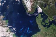
As part of the US Environmental Protection Agency’s Ecosystem Services Research Program (ESRP), we are evaluating how changes in nutrient loads impact the delivery of ecosystem services in lakes in the Northeastern Region of the United States (Figure 1) [5]. Obtaining bathymetry data for even a small percentage of the lakes within this region has been difficult and has forced us to model lake depth and volume using existing, publically available datasets. One key source of information that provides insight into lake depth is the National Elevation Dataset (NED) [6]. With this information it is possible to calculate changes in elevation surrounding lakes, which is likely similar to the change in depth within lakes as the same processes formed the surrounding topography and the lake basin [1]. Thus, we assume that lake basins surrounded by steep topography are likely to have a steeper slope and greater changes in depth than do lake basins with lower topographic relief.
There are two goals of our research. First we develop a method to estimate maximum lake depth for all National Hydrography Dataset Plus (NHDPlus) lake polygons in the Northeast U.S. (USGS Major River Basin 1) with sufficient accuracy for regional scale studies of nutrient cycling and ecosystem services. Lastly, we make the predicted depth predictions, as well as the scripts used to generate those predictions freely available.
Full study, including methods, results and discussion, published under open-access license in PLOS ONE.
Featured Image: Long Pond in Lakeville, Mass., January 2013. (Credit: Wikimedia Commons User Faolin42 via Creative Commons 3.0)